Airborne Measurements and analysis of Emissions over the Denver-Julesburg & Piceance (AMED)
Where: Colorado Front Range
When: 15 October - 15 November 2023
Who: Institute of Arctic and Alpine Research (INSTAAR) at University of Colorado Boulder (CU Boulder), Department of Atmospheric & Oceanic Science at the University of Maryland (UMD), NOAA Air Resources Laboratory (ARL), Cooperative Institute for Research in Environmental Sciences (CIRES) at CU Boulder, and NOAA Chemical Sciences Laboratory (CSL)
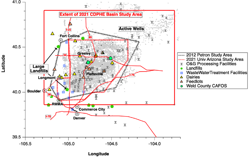
This project is focused on quantifying emissions of methane, ethane and selected volatile organic compounds (VOCs) from the Denver-Julesburg and Piceance basins in Colorado. It will include airborne and ground based mobile measurements. The University of Maryland (UMD) Cessna 402B research aircraft will make measurement of methane, ethane, carbon dioxide, carbon monoxide, nitrogen dioxide and a suite of volatile organic compounds (VOCs). These measurements will be augmented by measurements of similar suite of species from the UMD/NOAA ARL's Air Research Car (NOAAs-ARC). Total emissions from the surveyed basins will be determined from airborne measurements using the mass balance method.
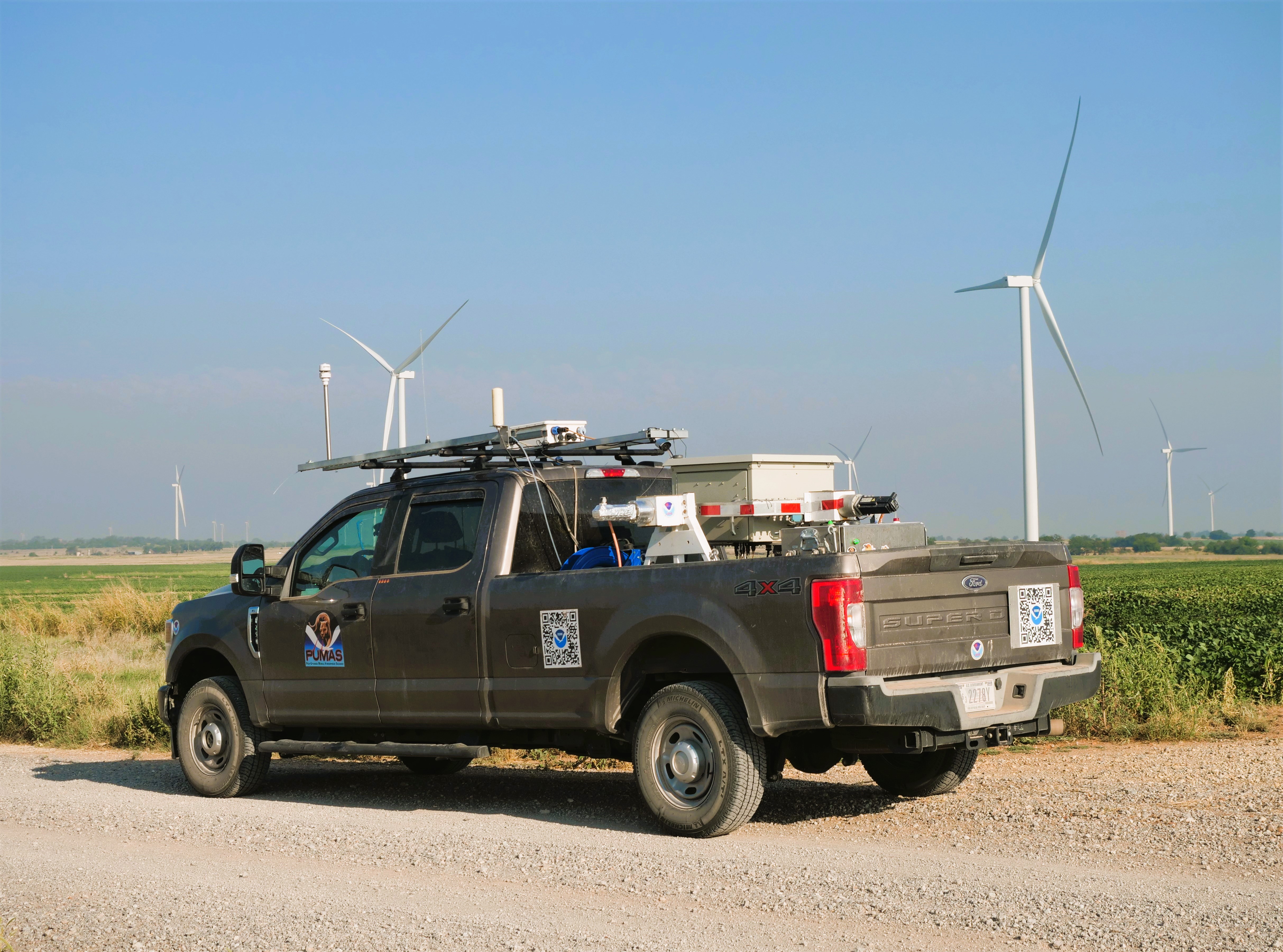
CSL deploys the PickUp based Mobile Atmospheric Sounder (PUMAS) Micro-pulse Doppler lidar (MicroDop) to measure wind and turbulence profiles, and boundary layer height to constrain uncertainty in emission estimates due to variability in wind field.
This project is funded by the Colorado Department of Public Health & Environment (CDPHE).