LLLJP Instrumentation: 120-m meteorological tower
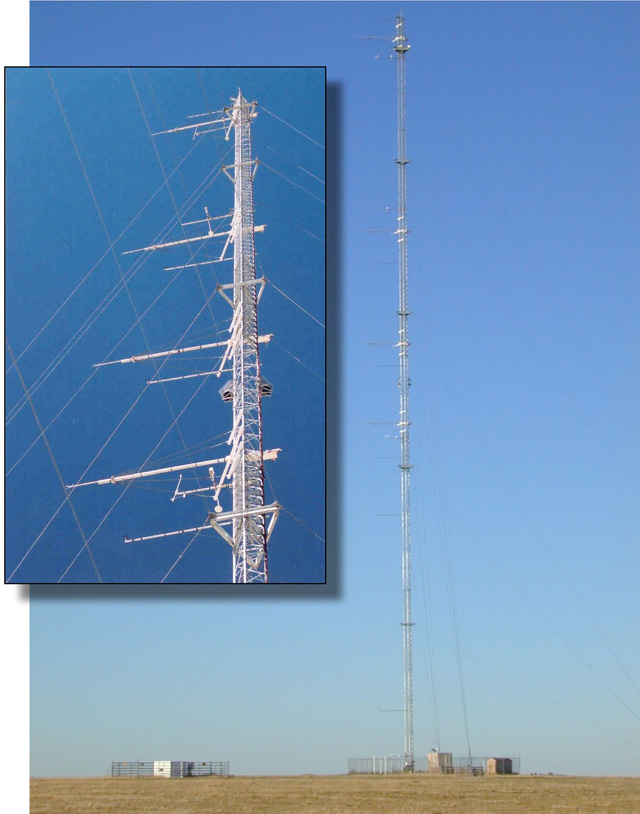
120-m tower and the sonic anemometers
A 120-m tall meteorological tower was installed at the LLLJP site by General Electric Wind Energy. The geographical coordinates of the tower were 37.6683 °N and 102.66375 °W. Its base was at an elevation of 1357 m above mean sea level. NREL instrumented the tower with three-axis sonic anemometers (Applied Technologies, Model SAT/3K) mounted at heights of 54, 67, 85, and 116 m AGL, to provide three-component wind and virtual temperature data at a sampling rate of 20 Hz on all data channels from 1600 to 0800 local standard time (2300-1500 UTC).